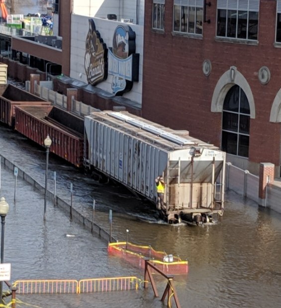
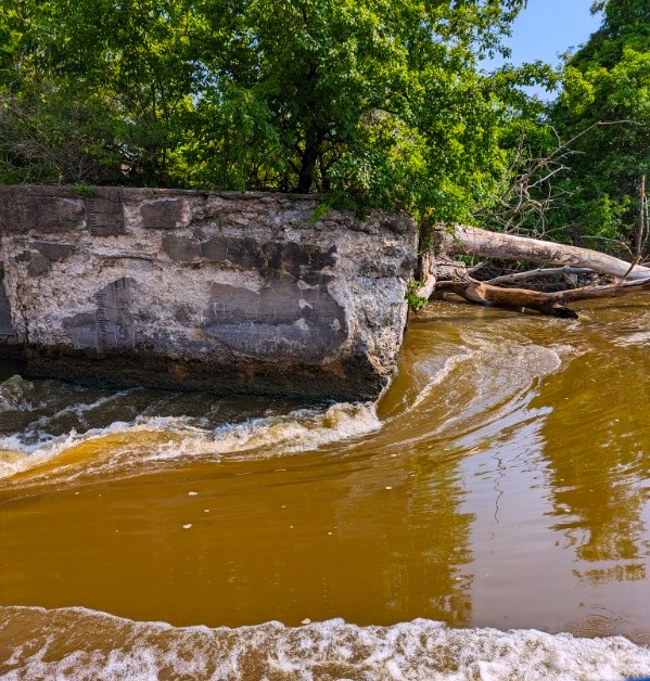
When you live by a river, you can expect occasional floods but this is an amazing shot of what it is like today. This photo was taken by a drone and placed on the cities website.
This is Davenport, Iowa, part of the Quad Cities area where 4 cities live, 2 on each side of the mighty Mississippi River. Usually at spring thaw after a high snow winter, we see this – never in July. But we have be inundated with storms and high rainfall since spring. Thus we have roads on both sides of the river closed due to flooding.
Some may think this photo is fake, AI or photoshopped but I assure you it isn’t. The ball park, Woodman Park, is on a little bit of a rise, plus it is surrounded by a higher retaining wall that the rest of the park. The blue line shows approximate location of the sidewalk retaining wall for the park which is usually 3-5 feet above the river.
You can seen to the far right the railroad track. It was recently raised due to being flooded out each spring. Here are a couple of photos of that same stretch of track in 2019.
Water has a power that is hard to match. I guess that is why we try to harness it power with dams to make electricity.
I am sure each area where we live has its own battles with mother nature, I just thought I would share mine. Stay safe and remember to share kindness, especially when times are hard.
If you had been following my two prior posts about my adventure on the river, this will be the final one as I share the amazement of Lock & Dam #16 on the Mississippi River.
I did not realize until this adventure how many dams there are on this river and actually how many rivers across the world share this same lock and dam technology. This part of the trip was my real reason for going. I love seeing how things work, so I will share some of things I thought interesting and maybe it will be interesting to you as well.
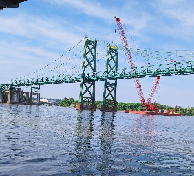
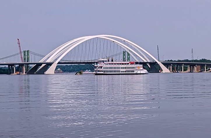
As we head downriver, the new I-74 bridge is the first structure we see. The official name for the bridge is the Iowa-Illinois Memorial Bridge. It replaced the old metal structured bridge which is currently being taken down.
At night, there are colored light that really show the beauty of this bridge. Depending on the season or holiday, the colors will change. Before getting to the bridge, there is this pile of boulders right in the middle. There evidently is enough soil on this small rock island to grow vegetation and usually it is surrounded by pelicans but today they are further down river.
Notice the numbers on the post with the orange caution signs…these are mile markers. The entire river is numbered and posted periodically. While there is no mileage map of the river, it is on a GPS of the river for the boat captains who use this river to know where they are at any given location. Our guide told us the number of products that in a year average up and down this river and I was amazed. Without the help of our rivers, a good portion of the products we use would be less getting to us.
As we got under the new I-74 bridge, you could see the old one as it is being dismantled and taken down. This twin bridge was originally a single bridge but as the area grew, it needed to be larger.
The first span opened in1935 as a toll bridge. In 1959, an identical twin span was added to satisfy increased traffic. The twin spans were upgraded to carry interstate traffic in the mid-1970s. Built for a daily crossing of 48,000 vehicles, the daily average at its closing was 80,000, making it by far the most traveled bridge in the Quad Cities.
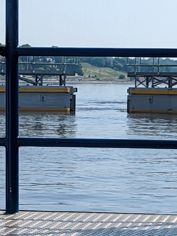
From the bridges, we headed to Lock and Dam #16. Upon entering, we tied off to the side and waited for the gates to close.
The lock system uses gravity to lower the water. Underneath the lock chamber are deep tunnels and when the gates are locked, the weight of the water above the tunnels pushes the water through the tunnels which lowers the boat.
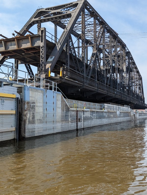
You can see how far the waterline fell for us to be able to exit the lock chamber. Because the lock is so close to the Arsenal bridge, when the river is running high, which it is now, the bridge has to open for boats to be able to pass under it.
This section of the bridge is operated by a trolley car engine that allows it to rotate 90 degrees allowing water traffic to pass by the bridge.
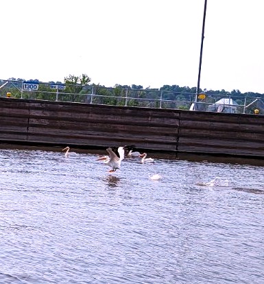
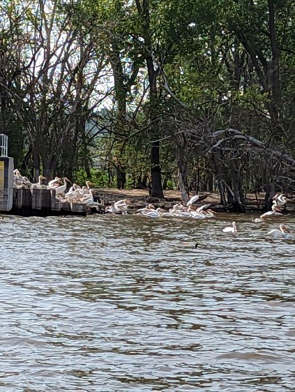
Because this section of the water flow is controlled and relatively calm, the downward river side is a haven for pelicans and other water birds.
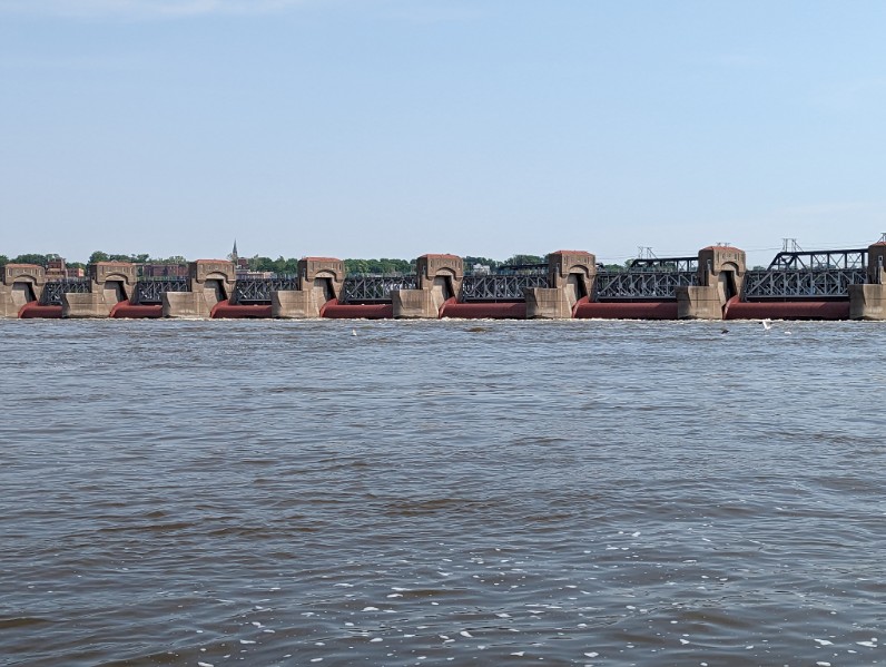
Once we were out of the lock, we could see the roller dam. From what our guide told us, this is the largest roller dam in the US. He also told us that the knowledge they learned when making this particular lock and dam was used when they made the much larger Panama lock and dam system.
The water coming through the roller dam was a lot more turbulent than the water from the lock. The purpose of the roller dam is to break up and control ice flows during the winter.
As we traveled further down river we could see the Centennial Bridge but we turned before we got there and headed back to the dock.
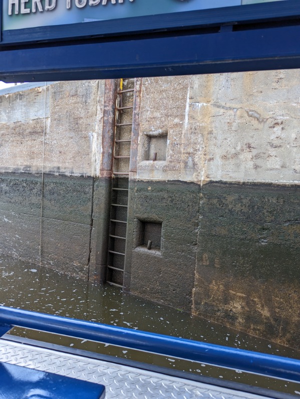
Before returning to the dock, we went through the original lock from the late 1800s which is no longer in use but was still interesting the way the water flows through it.
As we returned back through the lock we had a supervisor of sorts watching us to make sure we behaved…a blue heron. A really beautiful bird. He evidently is a regular guard.
All in all this was an interesting and fun excursion. I hope you enjoyed my photos and maybe learned something different. Below are some additional photos I took while on the river. Hope you enjoy them.
In closing I remind you of the beauty and power of kindness. The kinder we are, the hope is, the kinder the world will be. Lets at least do out part in always being kind.
If you read my post yesterday, you will remember I promised more interesting pictures today. When I was young I grew up on the rivers of Florida and saw wonderful wildlife and interesting plant life. The Mississippi River is a much larger river and throws out a different kind of beauty. The people who founded the Quad Cities area, recognized this beauty and built amazing homes along the river. Today I want to share a few of those homes. While I don’t have history on a lot of them, the few I do have, knowing these home are now close to or over 100 years old makes them more interesting. For instance…
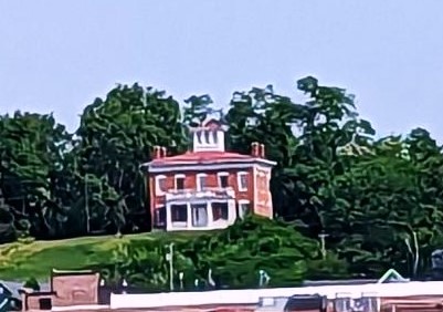
This house, built in the late 1800s is now a museum on the Rock Island Arsenal. It was built by a high-ranking military official…and the second one he built. I don’t remember on what military grounds they said he built the first one, but the government was not happy about it and took it away from him. They transferred him here where he proceeded to build another one. They tried to take him to court and fine him but he died before that could happen. The reason for their unhappiness…it was almost the size and opulence of the White House, where the President lives.
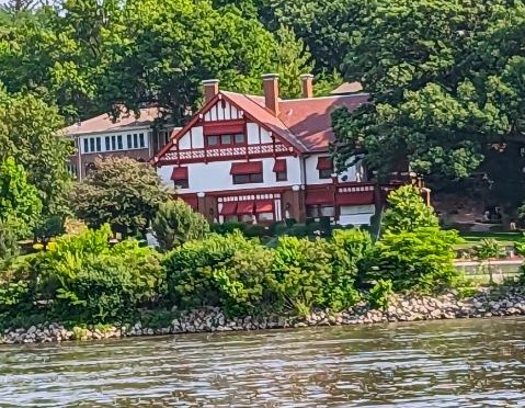
Another beautiful home along the river was built in 1855 by Antione LeClair, one of the founding fathers of Davenport, Iowa. I believe it is also a museum.
Below are other interesting home built along this section of the river. Some are more modern but still in the early 1900s.
This one below was one of my favorites, not because of it size but the design. I love the Victorian turrets.
I hope you enjoyed the pictures of the fun I had. Tomorrow I will share the pictures of the bridges and the lock and dam. Until then be safe and be kind.